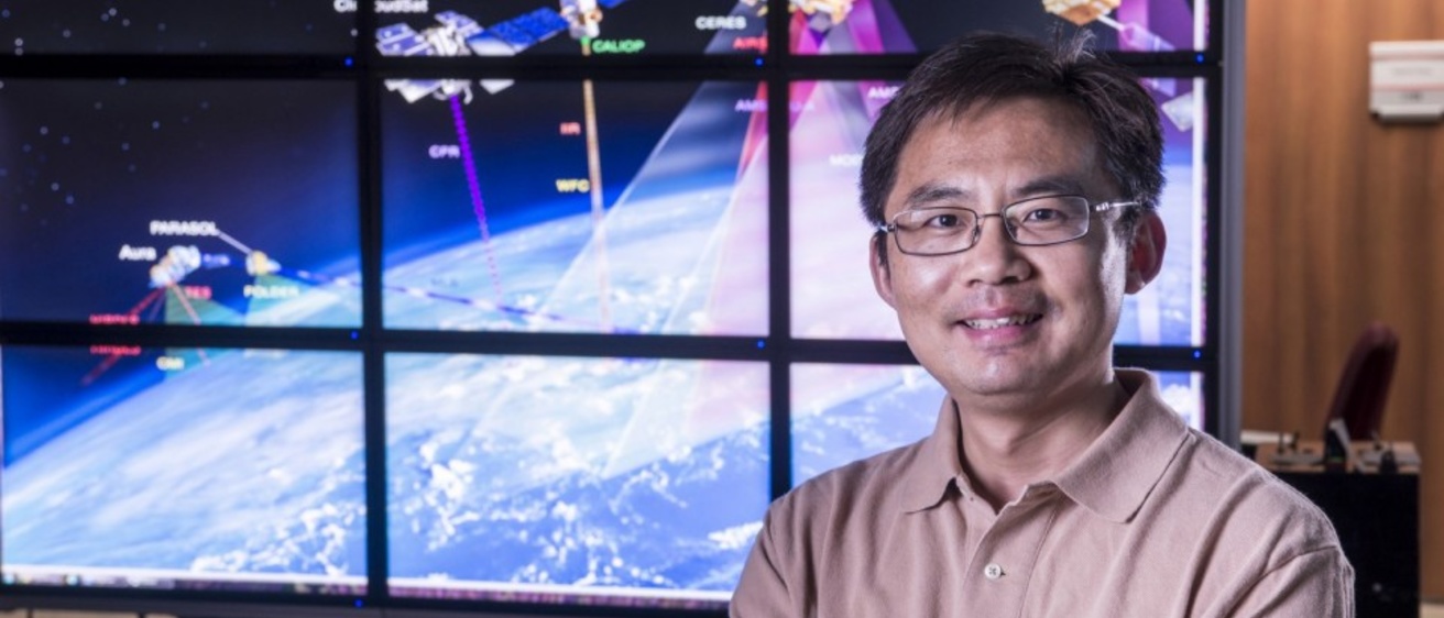
People: Jun Wang, professor of chemical and biomedical engineering
Center: Atmospheric and Environmental Research (AER) Lab
Mission Area: Environment and Energy
Raised without access to electricity, Jun Wang has come a long way to make a mark in atmospheric and environmental research.
The assistant director of the University of Iowa Technology Institute (ITI) is an integral figure in upcoming National Aeronautics and Space Administration (NASA) missions. He tracks global pollution, weather conditions and wildfires; leads a team of researchers in the Atmospheric and Environmental Research (AER) Lab, formerly known as the ARROMA Lab, at the University of Iowa; and was recently awarded the James E. Ashton Professorship in Engineering by the College of Engineering.
“My home village is close to the northern bank of the Yangtze River’s entry to the east Pacific Ocean near Nantong in China,” Wang says. “We have four distinct seasons, and my family was all farmers. From early on, I recognized that the weather has a huge impact on our lives.”
In an area of China renowned for kite workmanship and flying, Wang became fascinated by wind patterns and atmospheric conditions.
That fascination blossomed into a career in academic research addressing some of the biggest environmental challenges facing our world and inspiring the next generation of researchers as a mentor and teacher. His work has been recognized with the James E. Ashton Professorship, effective July 1, 2020, with an initial term of five years.
“This named professorship is a testament to your outstanding productivity, and value to the college and the university,” Alec Scranton, former College of Engineering dean, wrote in notifying Wang of the award. “I am delighted that you have been chosen for this honor.”
Wang left his hometown and completed his undergrad in atmospheric dynamics at the Nanjing Institute of Meteorology and his master's degree in the discipline at the Chinese Academy of Sciences, Institute of Atmospheric Sciences. He continued his education in the United States, completing a PhD at the University of Alabama-Huntsville. The close proximity to Huntsville's high-tech and federal labs, including NASA’s Marshall Space Flight Center, enabled Wang to focus his study on the use of satellite observation for the analysis of atmosphere and air pollutants. He received the prestigious NASA Earth System Science graduate fellowship to support his research.
“In my PhD, I began to develop research algorithms,” Wang says. “These algorithms can be applied to satellite data and can give you information on the amount of aerosols in an area, how close they are to the surface, how much cloud cover there is, where fires are.”
Wang says as weather predictions became more accurate and living standards increased, people began to think more about the environment and air quality. Finishing his PhD, he knew he needed to learn about atmospheric chemistry at a more complex level to study how different aerosols and pollutants move and interact. He went on to become a post-doctoral scholar at Harvard University for two years, under the support of the prestigious National Oceanic and Atmospheric Administration (NOAA) Climate & Global Change fellowship.
After his time at Harvard, he was offered a position at the University of Nebraska-Lincoln (UNL) where he continued his research and was recognized for his mentorship of students and researchers. At UNL, Wang laid the groundwork for projects that are still being developed today, like the High-Plains Real-time Earth System Modeling Complex (ESMC), which is funded by a $1.6 million grant from the U.S. Department of Agriculture. The ESMC provides up-to-date weather and air quality forecasts and tracks measurements for dew point and soil moisture, among others. The technology uses multiple data sources, including citizen data enabled by smart-and-connected sensors designed and manufactured in Iowa, to create accurate forecasts for farmers across the Midwest.
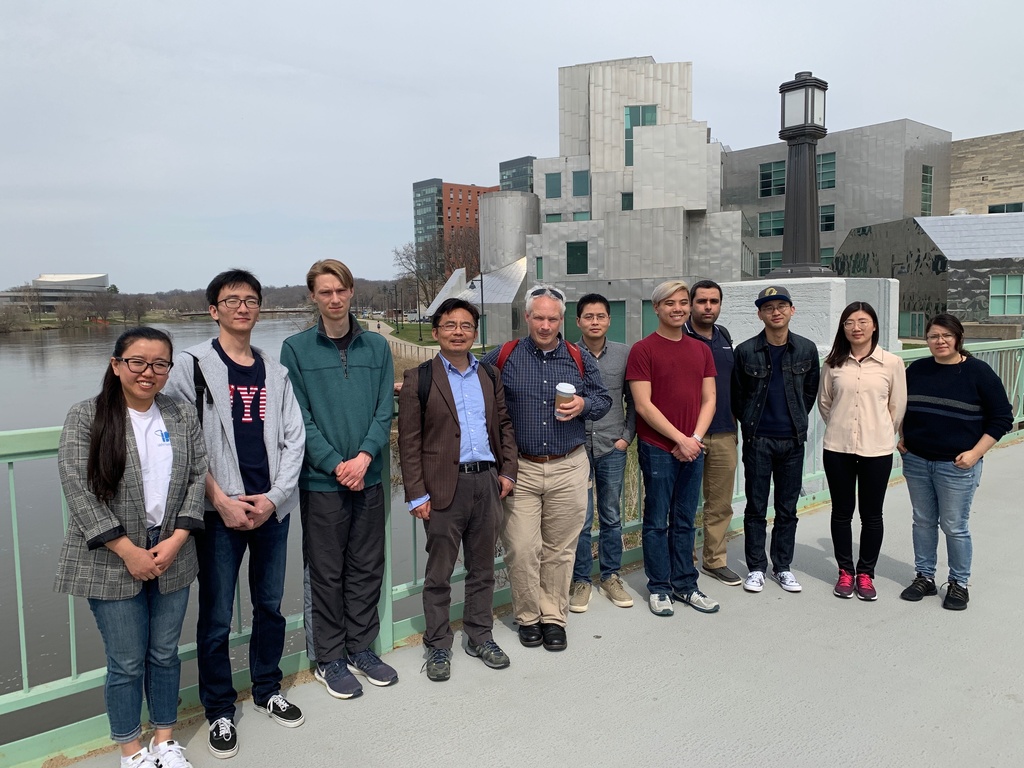
Wang joined the University of Iowa in 2016 and created the ARROMA (now AER) Lab. They are continuing work on the ESMC, researching the ferocity and path of forest fires using satellites to give real-time data to those on the ground, and expanding on Wang’s expertise in studying air pollutants from space.
His team is part of two $100 million satellite missions supported by NASA, developing algorithms and numerical models crucial in gathering and interpreting the data collected by devices on the satellites. These missions will be launched within the next two to three years.
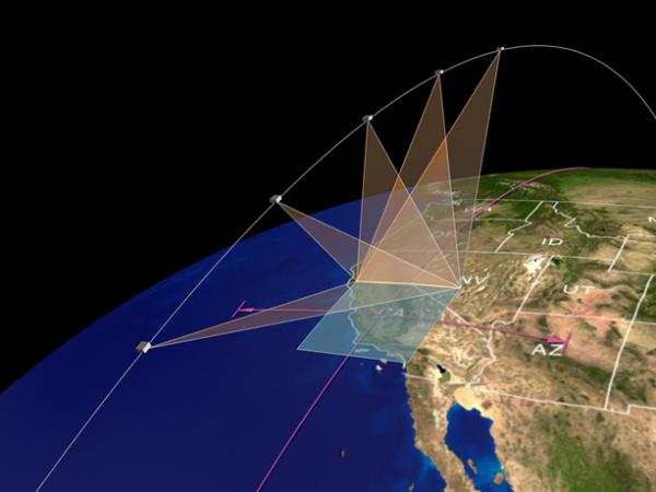
“How do you know what the weather and fires will be tomorrow?" Wang says. “Surface observations will never be sufficient to characterize the weather and fires. From space, we use satellite as a vantage point, and we can track global weather, fires, and pollution daily.”
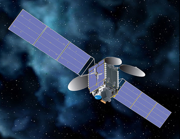
One mission led by NASA is TEMPO (Tropospheric Emissions: Monitoring of Pollution), a stationary satellite positioned over North America. When launched by SpaceX and operable in 2022, TEMPO will monitor major air pollutants across the continent, track hourly variations of many atmospheric elements, and pinpoint pollution levels to regions of several square miles at neighborhood scale. Wang is responsible for research algorithms that will track aerosol amounts and smoke plume height from TEMPO.
Another mission supported by NASA, Multi-Angle Imager for Aerosols (MAIA), aims to improve public health research. Tools on the satellite will track aerosol pollutants by measuring radiance and polarization of sunlight scattered by atmospheric aerosols. Upon analysis and with the use of a chemistry transport model developed by AER team, it can be determined where pollutants are located, how they travel through the atmosphere at various elevations, and what the chemical composition of these pollutants are. Researchers will compare data from MAIA with population health records to form more solid connections between air pollutants and health problems such as cardiovascular and respiratory diseases, adverse birth outcomes, and premature death.
“There’s a huge advantage in using satellite data to provide observations that you need to improve your predictions,” said Wang. “That’s why remote sensing of our planet is so important for predictions of air quality and the composition of air we breathe.”