The Fire Light Detection Algorithm (FiLDA) uses data collected from sensors mounted on a satellite to monitor fires around North America. The tool can help identify the location of a fire and its emissions and also inform those near the fire on its direction and ferocity.

The FiLDA was developed by Jun Wang, the Lichtenberger Family Chair in Chemical and Biochemical Engineering and ITI assistant director. Wang holds an appointment as professor of chemical and biochemical engineering in the University of Iowa College of Engineering. Wang also directs the Atmospheric and Environmental Research Lab, which puts the FiLDA to use in its research.
The Next Frontier in Remote Sensing of Fires
The next developmental steps in this field of technology include achieving the ability to determine the phase of a fire and the fire combustion efficiency, as well as understanding how oxygen plays a role in these processes.
This information can help researchers determine whether a fire is active and flaming or reducing and smoldering, a key differentiation in how personnel respond. A fire smolders when fuel sources like wood and vegetation are inconsistent, producing incomplete oxidized products, leading to the waning of the fire. If the fuel source is consistent and the fire has a steady cycle of oxidation, the combustion process will lead to the flaming and expansion of the fire.
Identifying from a satellite whether a fire is flaming or smoldering is difficult due to the variance of activity within a large fire. From a satellite, only flaming fires emit visible radiation.
How it Works
Sensors on a satellite gather data on fires in cloud-free conditions. This data includes the fire burn area, fire radiative power, subpixel fire temperature and area, and daytime smoke plume height at the fire source region. While all these measurements are important, measuring fire radiative power can give detailed insight into the mass, or fuel, consumed by the fire, leading to an estimation of how much CO2 is being emitted.
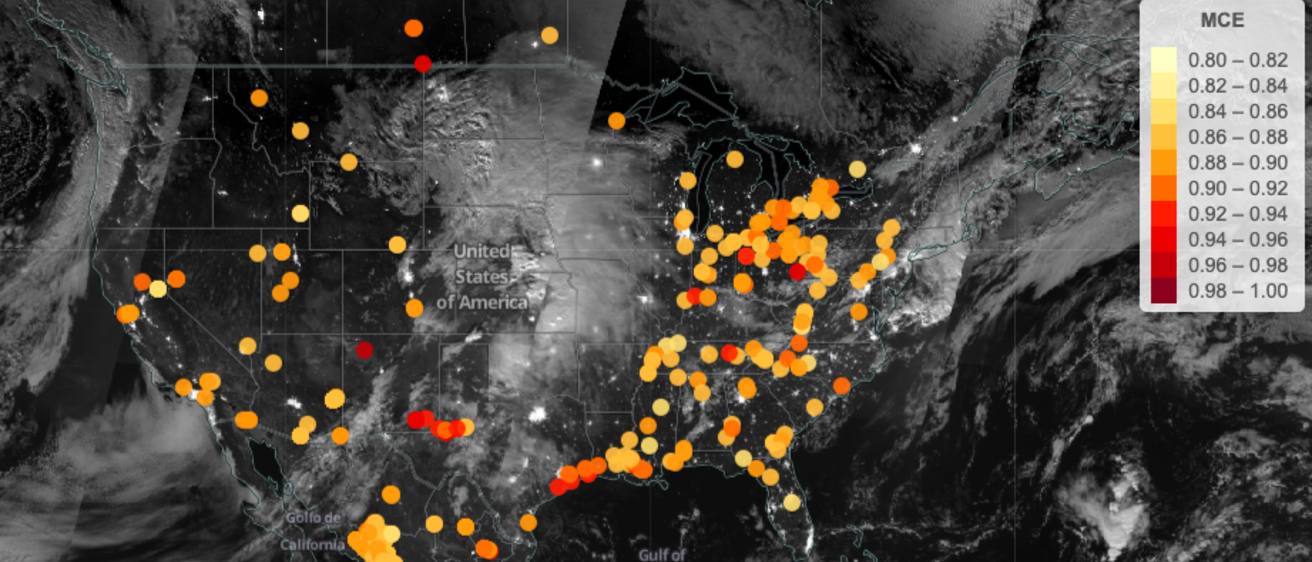
From this gathered data, emission levels and properties can be identified and the satellite can aid in accurate surveillance of the fire. The Earth System Modeling Complex (ESMC) website provides a map that gives daily updated information on fires in North America.
FiLDA in the News